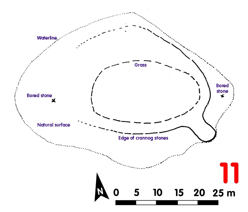
Crannog 11 Loch Awe[click on graphics for larger view in new window] |
Location: Achlian
Map reference: NN 115 247
Date of Survey: 29 September 1972
Loch level OD: 35.418 m
Highest point of crannog OD: 36.418 m
Top to bottom of crannog:
Overall spread: ca 30 m x 25 m
Usable area:
Description (1972): Natural glacial mound which had been surfaced to the E side with head-sized stones, the stones also possibly laid under the grass on top. Definite stone-built projecting 'jetty' facing SE 4.5 m wide x 7 m long.
Finds: Two bored stones, one due E and the other due W of centre: possibly thatch or net weights
Dating:
Post-1972:
CLICK TO ENLARGE
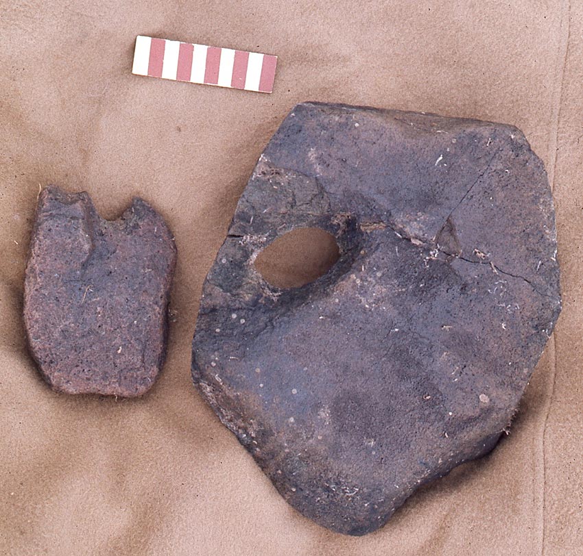
Possibly more an 'altered island' than a fully built-up structure, Crannog 11 yielded the two bored stones above
Back to front page